- Strona główna /
- Sport i rekreacja /
- Outdoor Sports /
- Wędkowanie /
- Marine Electronics /
- Marine Electronics Accessories /
- Navionics Plus Chart Plotter East
0 ratings



Nr produktu:
25970281
Navionics Plus Chart Plotter East
Nr produktu:
25970281
PLN 821
Szczegóły ceny
Bez kosztów wysyłki i cła ( Koszty wysyłki i cła zostaną obliczone przy finalizacji zamówienia )
*Wszystkie produkty zostaną zaimportowane z Stany Zjednoczone
0 ratings
Napisz recenzję
W magazynie
 Zaimportowano ze sklepu USA
Ilość:
Produkty dostępne w magazynie: 12.
Zamów teraz i otrzymaj około Piątek, Wrzesień 04
Bezpieczna transakcja
Ubuy dokłada wszelkich starań, aby chronić Twoje bezpieczeństwo i prywatność. Nasz zaawansowany system bezpieczeństwa płatności zapewnia poufność poprzez szyfrowanie Twoich danych podczas transmisji przy użyciu protokołów AES (Advanced Encryption Standards) i SSL (Secure Socket Layer). Twoje dane płatności są w 100% bezpieczne, ponieważ nie udostępniamy ich zewnętrznym sprzedawcom.
Nasi czołowi partnerzy logistyczni


Fish smarter with up to 1 foot HD contours and find the best fishing spots with enhanced sonar technology.

Szybka
wysyłka

Bezpłatny
zwrot*

Bezpieczne pakowanie

100% oryginalne produkty

Zgodność z PCI DSS

Certyfikat ISO 27001






Note: Step Down Voltage Transformer required for using electronics products of Stany Zjednoczone store (110-120). Recommended power converters Kup Teraz.


Co wyróżnia ten produkt
Detailed Mapping
Get access to highly detailed marine charts and mapping data for navigation, ensuring safer and more precise boating experiences in East regions.
User-Friendly Interface
The intuitive interface allows for easy navigation and quick access to essential features, enhancing user experience for boaters of all skill levels.
Regular Updates
Stay informed with regular data updates that enhance chart accuracy and features, ensuring you have the latest information available while out on the water.
Szczegóły Produktu
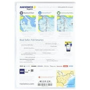
- Navionics+ is a powerful electronic chart solution providing more regional marine and lakes content than other product on the market! Get detailed Nautical Chart, SonarChart 1' HD bathymetry map, and Community Edits plus dailyupdates for one year! Includes full marine coverage and more than 6,700 lakes and growing in CT, DE, IL, IN, KY, MA, MD, ME, MI, NC, NH, NJ, NY, OH, PA, RI, SC, TN, VA, VT and WV, plus US waters of the region's Great Lakes. Nautical Chart and SonarChart are preloaded. Simply plug your card into your PC/Mac to download the most updated charts and Community Edits anywhere within the entire region. 16 GB card and USB reader included.Features:- Marine and lake charts- One foot contours - CT, DE, IL, IN, KY, MA, MD, ME, MI, NC, NH, NJ, NY, OH, PA, RI, SC, TN, VA, VT and WV all in one - 6,700 lakes and growing- Daily updates- Visit Navionics.com/downloads-updates to download the latest charts. - Enhance SonarChart with sonar logs you collect using a plotter or mobile device.- Includes one year of daily updates to Nautical Chart, SonarChart and Community Edits. - Check compatibility at navionics.com, which is continuously updated Specifications: - Card Format: Micro SD- Box Dimensions: 1 H x 5 W x 7 L - Weight: 0.30 lbs
| Series | Navionics+ |
| Model name | Regions - East Region |
| Compatible OS | PC/Mac |
| Accessories | 16 GB card and USB reader |
| Has written warranty | No |
| Retail packaging | Single Piece |
| Item Weight | 0.1 lbs (50 grams) |
Dla kogo jest przeznaczony?

-
Boating Enthusiasts
Ideal for avid boaters seeking detailed charts and navigational data for East Coast waters.
-
Fishing Professionals
Great for fishermen who require precise underwater mapping to locate fish and underwater structures.
-
Recreational Sailors
Perfect for sailors needing reliable navigation tools for exploring East Coast sailing routes and harbors.

-
Budget-Conscious Buyers
Not suitable for those looking for affordable mapping solutions as it's a premium-priced product.
OPIS PRODUKTU
About This Item
Upgrade your boating experience with the Navionics MSDNAVEA Navionics Plus - East. This comprehensive navigation system is designed specifically for the East Coast of the United States and offers a range of features to help you navigate with confidence. With the Navionics Plus - East, you can explore the East Coast's vast waterways, rivers, bays, and lakes with ease. Whether you're planning a fishing trip, a day of sailing, or simply cruising the coast, this navigation system has you covered. The detailed charting and mapping capabilities of the Navionics Plus - East will ensure you never get lost.
It provides accurate and up-to-date information on water depths, navigation aids, and hazards, so you can navigate safely and efficiently. Planning your route is a breeze with the Navionics Plus - East. You can easily plot your course, add waypoints, and even create a personalized fishing or boating plan. This navigation system also allows you to measure distances, track your speed, and monitor your position in real-time. In addition to its navigation features, the Navionics Plus - East is also a valuable tool for fishermen.
You can locate and mark fishing hotspots, track your catches, and analyze fishing data to improve your success on the water. Compatible with a range of GPS devices and chartplotters, the Navionics Plus - East is easy to install and use. Simply insert the MSDNAVEA card into your device, and you're ready to start exploring the East Coast. Upgrade your boating adventures with the Navionics MSDNAVEA Navionics Plus - East. Experience the convenience, accuracy, and reliability of this top-of-the-line navigation system.
Whether you're a seasoned boater or new to the water, this product is a must-have for anyone navigating the East Coast's waterways.
Masz pytania? Porozmawiaj z nami
Pytania i odpowiedzi klientów
-
pytanie:
What is the return policy for this product?
odpowiedź: We offer a 30-day return policy for your peace of mind. -
pytanie:
How often are the charts updated?
odpowiedź: Charts are updated daily with around 2,000 edits from various sources. -
pytanie:
What technology helps improve fishing spot discovery?
odpowiedź: The product utilizes SonarChart technology to provide HD contours and fishing spot enhancements.
Navionics Marine Electronics Accessories Editorial Review
**Editorial Review of Navionics 4013883 Regions - East Region** Customers have generally responded positively to the Navionics 4013883 Regions - East Region, praising its extensive mapping and detailed coverage of both lakes and coastal areas. Many users highlighted that the product meets their fishing needs exceptionally well, allowing them to navigate various waterways with confidence. The one-year free updates offered upon registration of the card is also an appreciated feature among users, adding value to the product. However, some customers noted a minor inconvenience regarding the software requirement for updates, indicating that it would have been helpful to be informed that the updates need to be performed on Windows 7 or higher, excluding earlier versions like Vista. Some reviews mentioned that while the quality of the charts is high, the cost of the card can be seen as steep compared to mobile applications that may offer similar features, drawing some comparative criticism. Nonetheless, users who prioritize thorough detailing and chart reading capabilities tend to favor this product. Overall, Navionics stands out for its reliable mapping solutions and provides users with a solid tool for their fishing adventures. **
Opinie i oceny klientów
1 oceny klientów
-
5 gwiazdka
100%
-
4 gwiazdka
0%
-
3 gwiazdka
0%
-
2 gwiazdka
0%
-
1 gwiazdka
0%
Zrecenzuj ten produkt
Podziel się opinią z innymi klientami
Zalety
- Extensive mapping covering numerous lakes and coastal areas
- High detail and quality of charts
- One year of free updates with card registration
- Excellent tool for avid fishers
Wady
- More expensive compared to mobile applications
Zaufanie do platformy i bezpieczeństwo kupujących

MA
Mohammad
Zweryfikowany kupujący
“Excellent quality and original too,when ubuy send original things I will appreciate that ,I very satisfied thank you”
23 July 2026 · via Trustpilot
CK
Chitra
Zweryfikowany kupujący
“The order and delivery progress was communicated very well. Package arrived within the estimated time. Products arrived as expected in good condition.”
22-Jul-26 · via Trustpilot
K
kund
Zweryfikowany kupujący
“Good supply of products. Safe payment methods, and shipment worldwide! Genuine products.”
23-Jul-26 · via Trustpilot
OO
Onesi
Zweryfikowany kupujący
“Was my first time buying a product from Ubuy, but I found it so helpful. This is reliable. Gonna place a new order!”
22 July 2026 · via Trustpilot
SJ
SAO JOHN
Zweryfikowany kupujący
“Ubuy is a great online platform to buy stuff. Reliable, fast delivery time and great value for money. I've been using Ubuy online shopping platform for three years now and will continue to do so.”
23 July 2026 · via Trustpilot
Bezpieczna realizacja zamówienia
Dostawa na cały świat
Łatwe zwroty
Oryginalne produkty
Historia ceny produktu
Ważne informacje
- Ograniczenia: W przypadku produktów wysyłanych za granicę należy pamiętać, że wszelkie gwarancje producenta mogą być nieważne; opcje serwisowe producenta mogą być niedostępne; instrukcje obsługi produktów, podręczniki i ostrzeżenia dotyczące bezpieczeństwa mogą nie być dostępne w języku kraju docelowego; produkty (i materiały towarzyszące) mogą nie spełniać norm wykonania, specyfikacji i wymogów dotyczących oznaczeń kraju docelowego; produkty mogą nie spełniać standardów dotyczących napięcia i innych norm elektrycznych kraju docelowego (co w stosownych przypadkach wymaga użycia adaptera lub konwertera). Odbiorca jest odpowiedzialny za sprawdzenie, czy produkt może zostać legalnie zaimportowany do kraju docelowego. W przypadku zamawiania produktów w sklepie Ubuy lub u jego partnerów odbiorca jest oficjalnie zgłoszonym importerem i musi spełniać wszystkie wymogi przepisów oraz regulacji kraju docelowego.
- Nie wszystkie produkty znajdujące się na Ubuy są na sprzedaż, ponieważ Ubuy to globalna wyszukiwarka. Produkty podlegają przepisom eksportowym/handlowym.
PLN 821
Zamów teraz i otrzymaj około Piątek, Wrzesień 04
Ten produkt nie jest ograniczony w moim kraju. (Kliknij powyższy link, jeśli ten produkt nie jest ograniczony w Twoim kraju, aby nasz zespół sprawdził i zezwolił na jego sprzedaż).
Ilość:
Produkty dostępne w magazynie: 12.
Bezpieczna transakcja
Zgodność z PCI DSS oraz certyfikat ISO 27001:2022, szyfrowane płatności i pełna ochrona kupującego przy każdym zamówieniu.
Nasi czołowi partnerzy logistyczni
Najszybsza dostawa międzynarodowa
Cechy i zalety
- Fast shipping on authentic parts.
- 30-day return policy for customer satisfaction.
- Discover hazardous areas and fishing spots with detailed shorelines.
- Create real-time 1 foot HD bathymetry maps with SonarChart Live.
- Daily updates with around 2,000 edits ensure you have the latest chart information.
- Advanced features available with select Raymarine models for enhanced navigation.
Gwarancja Ubuy
Ciesz się bezstresowymi zakupami dzięki 100% oryginalnym produktom, bezpieczeństwu płatności zgodnemu z PCI DSS, ochronie danych z certyfikatem ISO 27001, najszybszej dostawie międzynarodowej, bezpłatnym zwrotom* oraz bezpiecznemu pakowaniu przy każdym zamówieniu.